Keywords
Theme:
Bureau of Land Management, BLM
Place:
Arizona
Description
Abstract
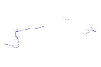
This data set is a general reference for the Streams that were assesed as being impaired in the state of Arizona as listed in the 2006/2008 303(d) Impaired Waters Report. (File has been clipped to BLM Phoenix District Office Boundary)
Purpose
For regional analysis and display at 1:24,000.


The intention with which the data set was developed is for general reference only.  It is representative only presenting a single point in time for the topic Impaired Streams 2008.  It is not the final or authoritative legal documentation for Impaired Streams 2008.
Supplementary Information
This dataset and other datasets in the BLM Phoenix District Office Geographic Information Database represent data for the BLM Phoenix District Office, and may include the Hassayampa Field Office and Lower Sonoran Field Office.


http://www.azdeq.gov/environ/water/assessment/assess.html
_________________
Status of the data
Time period for which the data is relevant
Publication Information
_________________
Data storage and access information
Details about this document